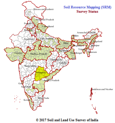
| Soil Resource Mapping | |
|
The Objective of SRM is to 1) Prepare soil map
on 1:50000 scale using toposheets and satellite remote sensing data 2) Generate district
based information on nature, extent and potential of soil resources 3)Develop a
methodilogy to reduce tiem and man power required for ground surveys 4) Delineate soil
mapping units using uniform legend.Methodology for Soil Resource Mapping: The steps
involved for conducting the soil resource mapping using remote sensing technique and
generation of digital database are as follows:- 1) Development of Legend
Click for Reports : Table Based | Map based |
 |